History of Mt. Pisgah Park

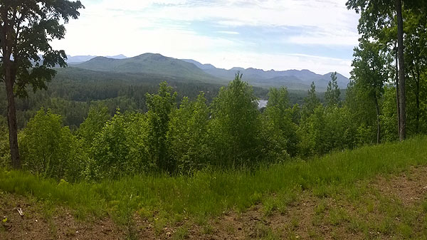
One of many views from on top of the mountain
This property was acquired by the Casiers in three stages. The first acquisition was in the 1960’s of what is now known as Mt. Pisgah Park.
The process of building the neighborhood began in 1908 when Mrs. Harriet Murchison divided approximately 50 acres of land that became known as “The Mrs. Harriet Murchison Purchase” and she called it “Grandview Park”. This is the origin of the name Grandview Avenue. At that time, there were almost no trees on the lower part of the mountain. The remains of a farmhouse was discovered on what is now lot three in Mt. Pisgah Park during later development. The original Grandview Park lots were small (40’ x 150’). Each of the existing lots in Mt. Pisgah Park are made up of several of the small lots that were shown on the original subdivision map in 1908. A number of lots in Grandview Park were sold in 1908. Over the years many of the lots were lost for taxes and became the property of Franklin County.
Beginning in 1966 much of the land remaining in private hands was acquired by Pisgah Park Inc. A Corporation owned by Frank Casier and Thomas B. Cantwell. Also in 1966 Pisgah Park Inc., started to acquire property that had been taken for taxes. In 1975 Pisgah Park Inc. acquired full legal title to the land that would become known as Mt. Pisgah Park after a quiet title action. Pisgah Park Inc. transferred all of the property to Frank Casier in September of 1976. At that time the Casier family was deeply involved with several other large projects: Lake Flower Park, Rockledge Park and Fish Creek Park.
In 1977 the entire property was sold to Tower Americana Land Corporation. However, that company failed and the property was reacquired by Frank Casier in 1981. By then the construction work on the Casier’s other projects was nearing completion and work on Mt. Pisgah Park resumed on a limited basis. Marketing of the 49 lots in the Mt. Pisgah Park subdivision began shortly after. The first individual lot sale in Mt. Pisgah Park took place in October of 1992.
In 1985 Audrey Casier acquired a number of lots that were the last pieces of the original Highland Park subdivision that included Park Avenue, Mountain Road, Grove Street and Old Military Road in the Village of Saranac Lake. At the time three of the lots had absolutely no value because they were at the top of a cliff and completely inaccessible. These parcels were labeled “The Palisade” on the Highland Park subdivision map.
Finally, in 1986, the Casier family acquired the land now known as Cliff Park from the Village of Saranac Lake. The land was subdivided into 21 lots.
The acquisition of Cliff Park also provided access to the previously inaccessible three lots from the Highland Park subdivision. This is the area we refer to as the Palisade.
In 2020 the owners of property in Cliff Park and Mt. Pisgah Park formed an Association to provide for future Road maintenance.
Tel: 802-863-1110 Cell: 802-373-9802